
GPS67 Multi-band/GNSS handheld with sensors and TopoActive maps
SKU
GPSMAP 67
Make more time for adventure with this premium, rugged handheld. Get long battery life and multi-band technology for enhanced accuracy plus preloaded TopoActive maps and access to satellite imagery.
$849.00


General
- Physical dimensions: 6.2 x 16.3 x 3.5 cm
- Weight: 230g with battery pack
- Water rating: IPX7
- Battery type: Rechargeable, internal lithium-ion
- Display type: Transflective, colour TFT
- Display size: 3.8 x 6.3 cm, diag 7.6 cm cm
- Display resolution: 240 x 400 pixels
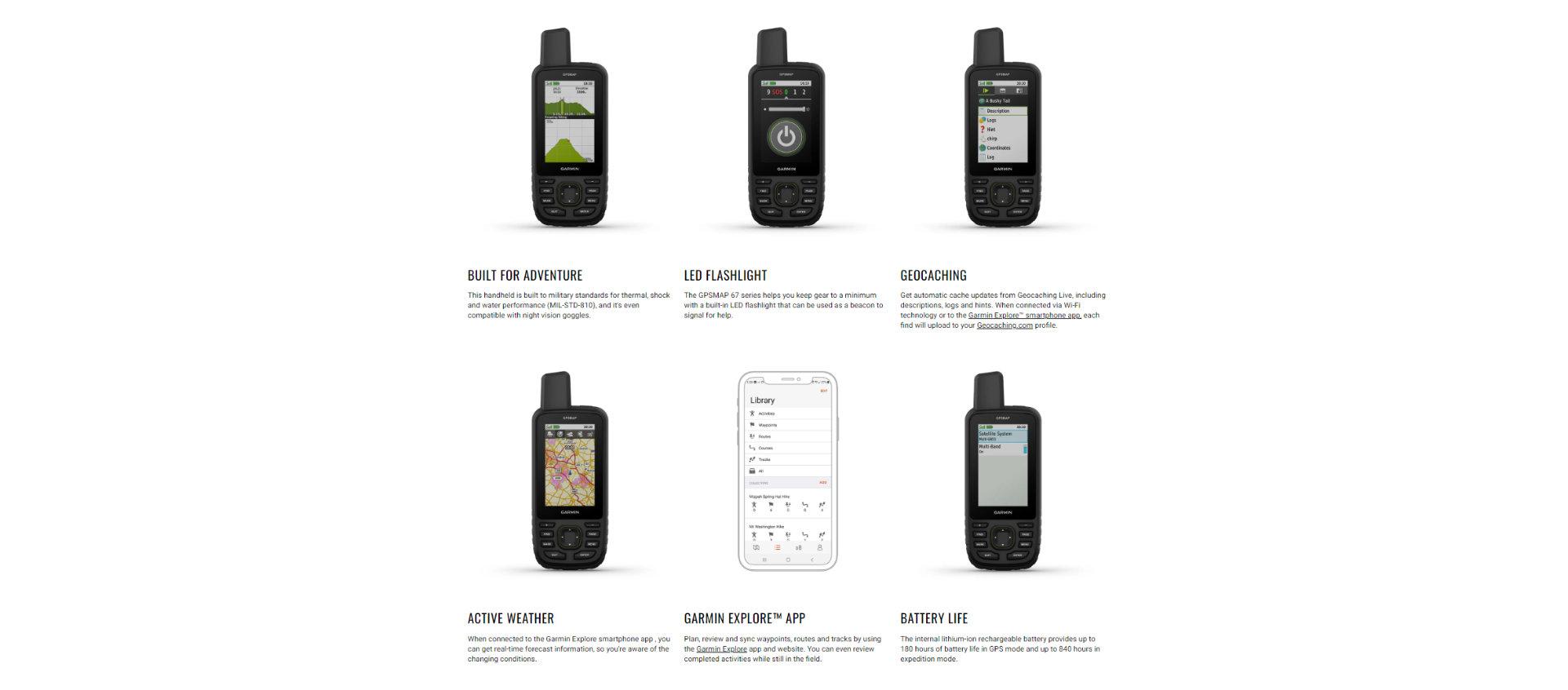
- Battery life: Up to 36 hours, up to 450 hours in expedition mode
- Memory/history: 16 GB (User space varies based on included mapping)
- Interface: High-speed mini USB and NMEA 0183 Compatible
- MIL-STD 810: Thermal, shock and water
Maps & Memory
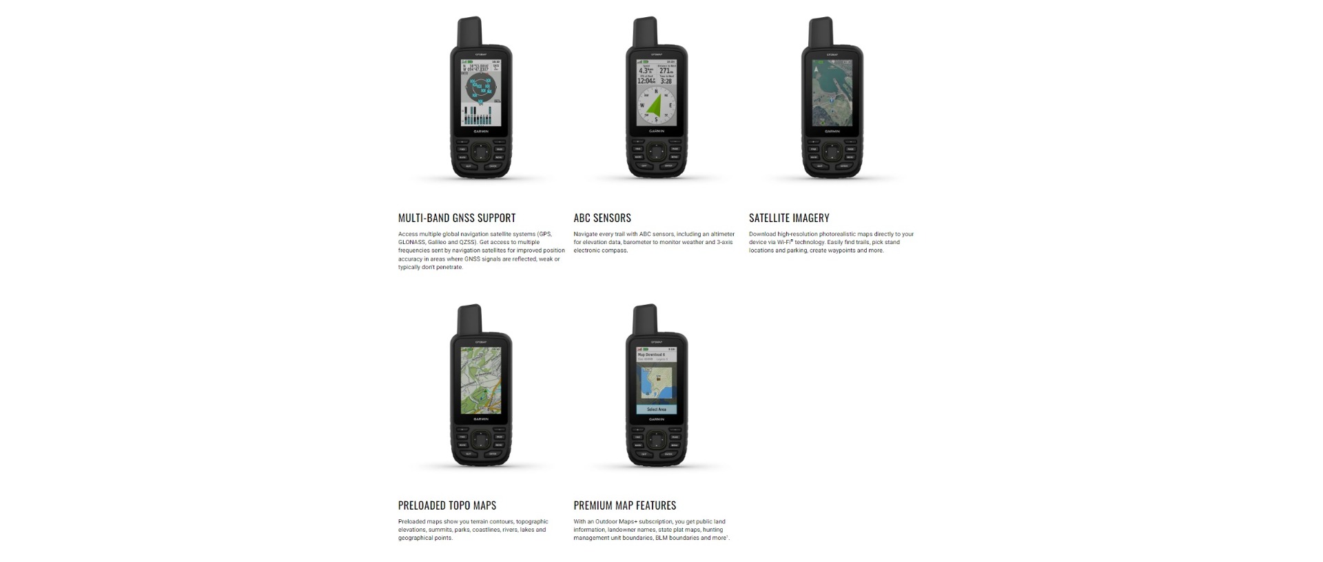
- Preloaded TopoAcive, routable
- Ability to add maps
- Basecamp
- Automatic routing (turn by turn routing on roads) for outdoor activities
- Map Segments: 15000
- Birdseye, direct to device
- Includes detailed hydrographic features (Coastlines, lake/river shorelines, wetlands, and perennial and seasonal streams)
- Includes searchable points of interests (Parks, campgrounds, scenic lookouts, and picnic sites
- Displays national, state, and local parks, forests, and wilderness areas
- External memory storage: 32 GB max microSD™ card
- Waypoints/Favorites/Locations: 10000
- Tracks: 250
- Navigation track log: 20,000 points, 250 saved gpx tracks, 300 saved fit activities
- Navigation routes: 200 routes, 250 points per route; 50 points auto routing
Sensors
- High-sensitivity Receiver
- GPS
- GLONASS
- GALILEO
- QZSS
- Baromatic Altimeter
- 3-Axis, tilt compensated Compass
- GPS Compass (While Moving)
- Multi-band frequency
Daily Smart Features
- Smart notifications on handheld
- Connect IQ (Downloadable watch faces, data fields, widgets and APPS)
- VIRB Remote
- Pairs with Garmin Connect Mobile
- Active Weather
Safety and Tracking Features
- Live Track
Outdoor Recreation Features
- Area calculation
- Point-to-point navigation
- Geocaching-friendly: (Paperless)
- Hunt/fish calendar: Yes
- Sun and moon information
- Picture viewer: Yes
- Custom map compatible: 500 tile
- Xero Locations
- inReach Remote Widget
- LED Beacon Flashlight
Outdoor Applications
- Compatible with Garmin Explore APP
- Garmin Explore Webiste Compatible
Connections Wirless Connectivity
- ANT+
- Bluetooth
Kit Contents
- GPSMAP 65sr
- USB cable
- Caribiner Clip
- Documentation
For more information on the Rino® 750, please download the following:
GPSMAP65sr